Wednesday, March 27, 2013

Things That Go Bump in the Night

We got an early start on Wednesday since our buddy boat, an Antares 44i catamaran, can smoke us on a reach in strong winds. We had some trepidation about this passage; it's 200 miles from Mayaguana across the trade wind belt to the mountainous island of the Dominican Republic. Typical weather conditions are 20 - 25 knot easterly winds and 8 - 10-foot-seas on your nose. Books have been written about how to do this passage, such as The Gentleman's Guide to Passages South - sounds so urbane, and we were following the author's advice to do the rough part of the passage at night when the winds (in theory) are lighter. If all goes well, we should get to our destination, Ocean World, about 29 hours later.

We left Mayaguana riding the leading edge of a cold front with 15-knot northerly winds, a somewhat rare wind direction this far south. This let us sail on a reach, but we did have 6-foot seas hitting us on the beam. This caused some drama about half way through the trip when I went down below to our aft bedroom and noticed some water on the floor. Removing one of the huge mattress pads I could see water was leaking around the head of our bed (the aft end of the boat) on the leeward (lowest in the water) side of the boat. I removed the teak trim piece that covers the chain-plate in that corner and immediately had water pouring onto the bed area. This type of event generally gives sailors heart palpitations. Luckily, once I removed the boards under the bed the water simply flowed into the bilge where the bilge pump pumped it out. But it was a lot of water and we were out in the middle of a big ocean and it was dark (everything bad on a boat happens at night).

When you see waves like this off your bow you know you are in for a rough ride.

Our worse nightmare, water entering the aft cabin. A bit of butyl caulk stemmed the flow for now.
Getting my flashlight I looked into the cavity and could see that there was an opening (part of the boat design to give access to some thru-bolted hardware) between the aft wall of our bedroom and the aft storage locker (on the transom of the boat under the steps where we store all our oil, wet suits, etc.) and that locker was completely full of water! Going outside the boat I could see the bottom step and the second step were mostly underwater from the bigger waves hitting us on the stern of the boat. I couldn't do anything about that since the dinghy mounted on the davits prevented any access to the area, so I went back to the aft berth and began stuffing towels into the opening. I then got some butyl tape (like that used for caulking windows) and placed it all around the teak cover piece and screwed it back on. Luckily it held and stemmed the flow of water to a trickle.

It was now around 6 pm and we were off West Caicos Island. This is where we had agreed with our buddy boat to make the decision to stay for the night or keep going. It was a tough call. The anchorage was very rough and exposed. I also knew there wasn't much I could do to solve the problem since we were in a very remote area with no facilities. We were also concerned that the marina we were headed to was exposed to the northerly winds and over next several days those winds would create larger swells that would make the entrance dangerous. We decided to continue on with some reservations about our choice.

As it got dark the wind increased to a steady 20- to 22-knots and the seas up to 8 ft. We were doing 7.5 to 8 knots under these conditions. We put a reef in the main (not easy in the big waves) and reefed the genoa down which made the boat more stable and with less dramatic swings as she surfed down the larger waves. We were now leaving the protection of the huge Turks and Caicos reef and venturing out into the 80-mile channel between The Bahamas and the Dominican Republic/Haiti. We had to sail as high to the wind as we could otherwise we'd be pushed down into Haitian waters, where our boat was not insured and also not a great place to hang out. Sailing closer to the wind was tough because it meant sailing into the larger waves (especially at night when you can't see them). We had a tense evening as we traded off on the helm every three hours while the other went down below to sleep (I didn't sleep, I just laid there and worried). I was confident the water situation was mostly contained so we just worried about sailing the boat in the rough and windy conditions (actually considered good conditions by those who have done this dangerous passage before).

The next morning both of us were a tad bit irritable from lack of sleep and stress, but the boat was sailing well and averaging about 7.5 knots. About 10 am, through the misty rain / squalls, we could see the mountains of the Dominican Republic. We were still trying to sail as far south on the island (up wind) as possible since 1) we didn't want to land in Haiti and 2) the first DR port was Luperon, which we'd heard was a tough port to enter with dirty water, nefarious characters, and greedy customs officials.

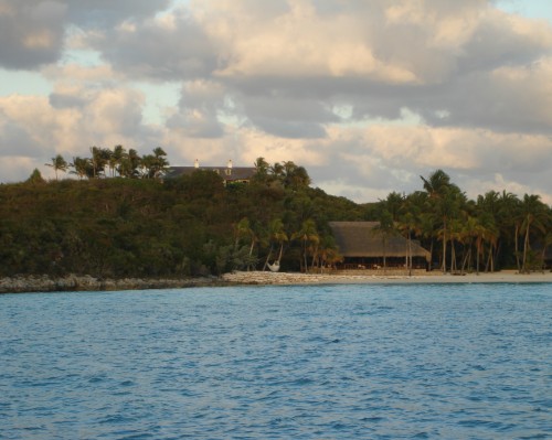
The breakwater off of Ocean World, Dominican Republic.
Our goal was Ocean World, a luxury marina development with a casino, great facilities, and a Sea World. While the waves crashing on Ocean World's breakwater looked intimidating, they weren't too bad when we entered the channel. Once we got in and tied up behind Field Trip the very friendly marina staff greeted us. Next Navy intelligence (don't ask me why) come down to inspect the boat and make sure we weren't carrying any cruise missiles. Then the marina concierge escorted us via golf cart to customs/immigration, which went very smoothly. The DR, along with most other countries in this area, is rife with graft and corruption. Here everything was above board and professional, which was great since we were both wiped out from the long (225 mile) passage and not in the mood to argue with anyone.

Flying Cloud and Field Trip taking a well deserved rest at Ocean World.

We moved to our slip and once we were tied up I went back and opened the flooded compartment to see my worse nightmare -- the entire compartment was flooded and a 2 ½ gallon oil container had opened and everything was covered with a thick coating of oil (at least it was fresh oil). Trying to deal with something like that on a boat is tough since the oil gets everywhere. Luckily none of it had made its way into our bedroom area. With me balancing on the very slippery transom steps, Meryl got out the oil spill pads and we began soaking up as much oil as we could. Naturally this was all making a huge oil spill in the luxury marina area. Looked like the Exxon Valdez had gone down. Once once we got the twenty remaining bottles of oil (for engine, genset, & outboard) out I could start soaking up the oil in the compartment with additional oil spill pads. Luckily there is no EPA in the DR although I felt terrible about the oil in the water. Luckily we had two quarts of liquid Joy dishwashing detergent that helped clean up and disperse the oil.

As physically and mentally tired as we were, I can't tell you how tough a job this was. The boat was bobbing up and down as the large waves hit the breakwater just behind us. My hands were coated with oil and just trying to hold on and not fall off the back of the boat was a challenge. My shoes felt like ice skates. Meryl had injured a rib several days earlier and bending over was tough for her. To add insult to injury (that was a nice segue way using a metaphor) the first thing we pulled out of the oily mess was our two wet suits. They were covered from head to toe with fresh oil like big, black sponges. Since oil floats on water, we first had to get the oil removed before we could pump out the remaining sea water and begin to clean the inside of the compartment with Joy. We got large black plastic bags to put the oil spill pads into, along with wads of paper towels dripping in the frothy oily mix. We then got a bucket full of hot water and Joy and washed off the 20-something plastic bottles of outboard oil, etc. and put them on the deck on an oil spill pad.

After three hours (remember we had been up all night sailing in heavy weather) we had the mess somewhat under control (did I mention it was raining hard the whole time) and we finally went down below to have a quick dinner and crash in our bed. Oh, wait, our bedroom was all taken apart since the water got onto our mattress, mattress pad, and sheets. Oh, well. We went forward, cleaned all our junk off the guest berth, made the bed, and collapsed. Thank God we had sold the bikes in George Town and didn't have to hassle with moving those off the guest berth and up on deck.

As you can imagine, this is one of those times you really question whether living on a boat is the right thing. Meryl is not a happy camper right now. Tomorrow I will try and figure out how water got into the transom storage locker and work on a plan to prevent this from happening in the future. Meryl has got a huge pile of laundry (some of it very oily) to do and we've got to replenish our stocks of paper towels and liquid Joy. We'll probably stay here for a week to sort all of this out (they do have a casino here).

To continue our voyage we have to move south along the DR's northern shore, which is a dangerous lee shore in the prevailing easterly trade winds. This means we'll be leaving port at night and sailing along the coast in the lighter night winds and then anchoring in little coves during the day. We then have one more hairy crossing, the Mono Passage, which lies between the DR and Puerto Rico. The Mono Passage has a reputation for getting really nasty so we'll have to plan our weather just right. Then we'll clear into Puerto Rico (where they have Wal-Mart's, McDonalds, etc.), to provision the boat, ship our kayaks back to the States, and slow down and begin enjoying the cruising lifestyle a little more. We'll also have to start learning to speak Spanish if we ever want to eat anything in a restaurant, which should be interesting.

Sorry for the long post, just wanted everyone to understand the realities of cruising and that sometimes you have great days laying under palm trees and other days can present challenges like this. We are looking forward to being once again at anchor at some lovely isle, sipping Pina Colada's as the sun slowly sets in the west, and contemplating our navels. I have to add that through this whole disaster it was very reassuring to know that our buddy boat, Field Trip was close by and watching our back.

Thanks guys.

Thursday, March 21, 2013

Finally, A Light Wind Passage

Although we've had a lot of o'dark thirty departures, today was an easy 9:30 am departure into some very light southeasterly winds. Field Trip was kind enough to share the automated weather routing information generated by his MaxSea navigational program.

Weather Routing Module in MaxSea navigational software.
It downloads GRIB files (automated "guesses" of what the wind will be over the next 3 days) into the computer and then overlays the currents and sailing characteristics of the specific boat (in this case an Antares 44i catamaran) with the desired route you want to sail. The computer then generates this spiffy color screen that takes your rhumb line course and adjusts it to take advantage of changes in wind direction over the time period you will be sailing. Not perfect, but another tool skippers use to plan their daily passages. Our boat, a 44 ft. monohull, has different sailing characteristics than a cat so we can only use some of the suggested routing.

Mark, Walter, and Meryl ponder various options for the passage to Mayaguana.
As always, captains get together and discuss their objectives and strategies, but at the end of the day each captain has to plan his own route. Since the initial route was a little more up wind, we had a slight advantage in that a monohull can sail higher to the wind than a cat, therefore we were several miles ahead of Field Trip during the trip. All in all it was a pleasant day sailing in very light winds, with speeds of 3 to 5 knots at times. This wasn't necessarily a problem since we had 142 miles to sail and wanted to arrive at Mayaguana early the next morning so we could navigate the entrance reefs in good light. Compared with some of our other passages, we could actually go down below and walk around without feeling we were inside a washing machine on full spin.

Flying Cloud lying inside the lagoon at Mayaguana.
Mayaguana's entrance looked tricky on the chart with coral heads and shallow water, but in reality it was fairly easy to pick our way around the coral and anchor just short of the protective barrier reef in about 10 feet of water. Our first priority was finding some fuel given the upcoming long passage to the Dominican Republic. Mayaguana is a remote island with very limited facilities, so I just got on the VHF radio and called for a guy listed in the cruising guide who was supposed to have connections to get fuel. Another guy quickly replied that "so and so is dead" and that he could get us fuel.

Scully brought all my empty 5-gal. diesel tanks from town on his bike!
I borrowed five yellow 6-gal plastic diesel cans from Mark and dingied the three miles across the lagoon to the dock. The lagoon was so shallow Meryl and I managed to run aground IN THE DINGHY! We walked the dinghy in a ways until we could see a faint channel. There were two guys and a lady scrubbing the bottom of a dinghy, but unfortunately none of them were "our guy." Unfortunately when "our guy's" name came up, the three gave each other sideward glances and one confided in me that "my guy" wasn't all there if you know what I mean. My guy, however, did have a great handheld VHF so he could talk to incoming cruisers. My "new guy," Scully, told me the "old guy" would have to contact him to get any fuel anyway. Sure enough, Scully's phone rings and it's my "old guy" talking to my "new guy." I basically said I needed 30 gallons of diesel and "you guys" work it out. Scully said the only diesel was on the other side of the island and it would cost $50 just to get there in a cab -- if there were a cab -- which there wasn't. He said he had a buddy who could pick the diesel up after work and to contact Scully the next day. I left Field Trip's yellow diesel cans with Scully and left, Meryl and I shaking our heads and hoping we'd see those yellow diesel cans at some point in the future.

The next morning Mark volunteered to take my in his dinghy, which has a stronger motor and more carrying capacity. When we got to the dock there was a couple big plastic drums, but no people. You learn patience cruising. We waited for awhile and soon Scully came up the road carrying the 5 yellow plastic jerry cans (quite an accomplishment). We siphoned the diesel from the big drums to our yellow cans and discussed the state of the world with Scully. He loaded the jerry cans into our dinghy and I handed him $240 which at $8 a gallon makes it probably the most expensive diesel fuel in the world. Normally we can fill our 118 gal tank for much less than that. Well when you need it, you need it. Just the experience of talking with Scully, with his long Rastafarian dreadlocks tucked into his wool cap and his deep accent, was worth it. Went back to the boat and very, very carefully poured the diesel into the tank.

Mark showing me the "super siphon" method he picked up from Nigel Calder's book.
One good thing, Mark showed my a cool way to transfer the diesel: you put a ½ hose in the jerry can and other end in the tank, then take a small funnel or tube, put it in the top of the jerry can, seal with a rag, and blow until the tank is pressurized and the diesel start siphoning into the tank. No mess, no fuss. Thanks, Mark (and Nigel Calder). 

Later Mark offered to show me the rope of spearfishing. In The Bahamas you can only use pole spears and free diving (no SCUBA tanks) to spearfish, a great policy since most of the fish are gone anyway. I had carried a pole spear for the last several months but never used it. Mark was spear fisherman extraordinaire. He gave me the lowdown on how to do it: basically swim up to the fish, spear it, surface with the fish before the sharks eat you. The problem was I couldn't hold my breath as long as he could; he would go down and hover outside the nooks and crannies where the big fish hide and then spear them. I found some rather daring (or stupid) snappers called a yellow schoolmaster (I felt bad since Sara is a teacher) and managed to shoot my spear at one. It hit him but didn't penetrate and he was just lying on the bottom stunned and looking up at me with those big eyes saying "So what did I do today to piss you off, dude?" Well, now you know why I'm not a good hunter/gather. He did taste fairly good when Meryl cooked him up for dinner that night.

Mark meanwhile was stalking a big grouper that managed to stay just out of his reach in the caves. He got some other fish, but the problem is the minute you spear a fish the sharks start coming from out of the woodwork. You've got to get to the surface, get the spear with the fish in the air, and quickly swim back to the dingy before you're dinner for some shark. Snorkeling on the ocean side of the reefs is a lot of work, the ocean waves hit the reef and bounce back making the water very confused and with big waves. Meryl and I were wiped out after our big adventure and crashed when we got back to the boat. You keep remembering when you're doing this stuff that you're way out in the middle of nowhere and there is no US Coast Guard or 911 to rescue your ass if something goes wrong. That's the value of having a buddy boat with you.

ack at the boat and sleeping in the cockpit I hear the VHF crackle to life. It's Sara on Field Trip and she's asking for a favor. Apparently she came out of the cabin and saw a dinghy off in the distance. She mused that it might be some other snorkelers or fishermen. Then she thought that it looked a lot like their dinghy. Then she realized it was their dinghy. I can just hear the conversation: "I thought you tied up the dinghy. No, I thought you tied it up." Anyway, buddy boat to the rescue as I speed off (I like to speed off) to rescue the dinghy and to be hero for the day.

A wonderful piece of art from 5-year-old Michael on Field Trip.
One of the very nice things we got from Field Trip were a pair of drawings that Elizabeth and Michael made that we hung on the walls of our boat. They are both very good artists!
We were now on our fifth day in Mayaguana since we were waiting for a good weather window for the long passage to the Dominican Republic. A long rumored northerly was working its way down from The Bahamas and Mark was using his satellite Internet connection to keep track of the weather.

The next leg was a biggie, over 200 miles past the Turks and Caicos banks, then across a long stretch of ocean known for strong winds and big waves, normally strong tradewinds from the east. Our plan was to leave around 7:30 am the next morning and evaluate our progress as we neared the southern part of the Turks and Caicos near French Cay. If it was too rough, we could duck in behind French Cay and wait out the weather.


Tuesday, March 19, 2013

The Path Southeast (with New Friends)


Our next challenge was to sail 400 miles southeast (into the wind the whole way) from the relatively populous Exuma Islands to the nether regions of The Bahamas and on to the Dominican Republic. We departed George Town around 8:30 am, winding our way around some shallow reefs with a wary eye to the reefs between Fowl and Guana Cays.


About one month earlier a brand new Lagoon 45 catamaran (expensive) was following the recommended route on Navionics chart and ran hard aground on a reef between the islands. Despite efforts of cruisers in the George Town area the cat was a total loss. We all depend on these charts and guidebooks, but it brought home the point that all of us are just a few minutes away from losing our boats if we make the wrong decision when transiting reef-strewn areas (essentially the entire Bahamas).
We took the deeper channel south of the wreck site and began a long 26-mile close reach southeast to Calabash Bay on Long Island. The weather gods had predicted a weeklong weather window of somewhat moderate winds all the way to the Dominican Republic so I was surprised to see only a couple other boats departing Elizabeth Harbor. Over thirty boats had attended Tassie Dave's Heading South seminar a couple of days earlier and I had expected to see a flotilla of boats leaving during the brief weather window.

We had met the young crew of an Antares 44i catamaran called Field Trip at the Tassie Dave meeting the day before and discovered we were both leaving on the same day and agreed to contact each other once underway. Thus is the beginning of what is known as a "buddy boat" relationship. Just like a real relationship, you first have a coffee date to see if you have anything in common and then go from there. This first leg was our "coffee date." We called each other a couple of times during the day to see how things were going. The sail to Calabash Bay was relatively easy, but we were tired once we arrived so we just checked in with Field Trip on the VHF to see what time they would be leaving in the morning. Calabash Bay is an open roadstead-type of anchorage with the potential of a rolling swell in a northerly wind. Luckily we had relatively light wind and got a good night's sleep.

We left Calabash at 9:30 am on March 20th for the 35-mile sail to Rum Cay. As usual we had the wind on our nose and motor sailed the entire way to Port Nelson at Rum Cay. At Rum Cay you enter through some breaks in the reef, always a challenge with our 6 ft. draft in the shallow waters. There is a marina there that got hit hard by Hurricane Sandy and was offering free mooring, but once we looked at the run down docks we opted to anchor out. We got a quick coat of varnish on the starboard rail (coat #6) then got a call from Field Trip with an invitation to go snorkeling on the reef off Sumner Point. Their friends had said the snorkeling was fantastic, but it was over 30 ft. deep on the outside of the reef and with the waves rolling in, it was a little rough for us.

The crew of Field Trip:  Sara, Mark, Michael, and Elizabeth.
Field Trip invited us over for a drink and we had an opportunity to meet Sara and Mark from Castle Rock, Colorado (near Denver) and their two delightful children, Michael age 5 and Elizabeth age 8. Elizabeth is the apple of her father's eye and snorkels right alongside her dad. She inherited her mother's beautiful eyes and sparkling personality. Michael, with a mop of sun-bleached blonde hair, has an impish personality that is endearing. Sara, a licensed elementary teacher, is home schooling the kids each day (now you understand the name of the boat, Field Trip). She has the looks and carriage of a super model, coupled with an engaging personality and broad smile that puts people at ease and makes friends. As a family they have decided to take a mid-career break and sail around the world. Sounds reasonable to me. What an opportunity to explore new cultures, lands, and experiences with your children. I so wish we would have done this with Christa and Brad at the same age.

The beautiful Antares 44i, Field Trip.
Mark, a former tech consultant, supervised the construction of their Antares 44i in Argentina. I could write a whole post about this incredible boat, but we'll save that for later. Let's just say it falls in the "dream boat" category. Mark sailed the boat up the coast of South America to the Caribbean where he met Sara and the kids and continued the trip up the US coast to Maine for the summer, then back down to The Bahamas where we ran into them. Mark and Sara epitomize qualities of the perfect buddy boat, knowledgeable, kind, generous, and forgiving of our frequent delays for equipment issues. As an uber-techie (yes, I've met my match) he has satellite Internet on the boat and can download weather forecasts for each leg of our trip. He's even been so kind to email me copies of the weather routing and routes generated by his MaxSea software (the same system we use on Flying Cloud).

We are so grateful to have met them and to be able to cruise various portions of our trip south with them. Again, I could write an entire post on how generous they have been to us, but most important has bee the opportunity to be around the magic of young children that reminds us of our children and grandchildren. Thanks so much, Mark and Sara, for letting us tag along.

Friday, March 8, 2013

The George Town Boogie


The trip to George Town was a brisk downwind sail in 20-knot winds on another beautiful blue-sky day. George Town is located on Great Exuma Island and the anchorage is about two miles across Elizabeth Harbor along the shores of Stocking Island. George Town is the equivalent of Roche Harbor in the San Juan Islands, or maybe Block Island in Rhode Island. It's the place everyone wants to be and be seen. As we sailed into the broad Elizabeth Harbor we could see literally hundreds of sailboats anchored, mostly along Stocking Island. Some cruisers make a beeline for George Town in early November and don't leave until late April or May. You can tell them by the forest of marine growth on their hulls. As many as 400 boats can be anchored here during peak season.

 It's a huge harbor, but everyone wants to be anchored in one of three places: The Monument, Chat & Chill, or Sand Dollar Beach. Each has its advantages and disadvantages. Since we were only going to be here about a week we decided to shoe-horn ourselves in just off the Chat & Chill Restaurant, the most popular anchorage. You get to know your neighbor boats well since they are right next to you.

The dingy beach in front of Chat N' Chill.
The infamous Chat N' Chill on Stocking Island near George Town.
The second night we needed to get hooked up to Internet which meant taking your dingy into the St. Francis Yacht Club bar where they sell chits for 75 minutes of Internet. It was packed when I got there because they have a live band on Wednesdays. I jumped in the dingy and got Meryl, but by the time we got back it was standing room only. We managed to appropriate two chairs and set them up right in front of the band. How do I describe the band? Well, first their name was "Too Drunk to Fish." Second they were made up entirely of older guys off cruising boats. Third, they were incredibly good. They did a lot of Crosby, Stills & Nash, Jimmy Buffet, some vintage Ian and Sylvia (which I love), and some good Oldies rock songs. The place was rocking (albeit with people mostly in their mid 60s --- this caveat is to allay the comment I know my daughter is going to make). We had a great time, met some interesting people, and had the usual fun time steering our dingy trying to pick our boat out of the hundreds anchored in the dark.

The other institution at George Town is the morning radio net at 8:15 am on VHF channel 72. It is a hoot. Every boat has its VHF radio tuned in and the harbor kind of reverberates with feedback noise. The Net starts with a call for any emergency traffic (there never is any), then announcements by local business ("Good morning cruisers, this is Chat & Chill and we're having our pig roast this Sunday . . ."), followed by local announcements ("Yoga on Chat & Chill beach at 9," "Volleyball at 2," etc.) and then the For Sale section, ending with Recent Arrivals and Departures. Herman on White Wings runs the net and does a masterful job of orchestrating the bedlam.

We took advantage of the net to sell our two folding cruising bikes (they took up space and we weren't using them). We got two full price offers within about 20 minutes. Also sold our chart sets for the East Coast of the US. Selling something usually involves about an hour long meet and greet with the buyer and seller listening to each other's cruising stories.

VHF channel 68 is used as the local calling channel. "Hey, anyone want to make a run to the propane plant to fill your tanks?" There is a very strong sense of community among the cruisers (remember there's no US Coast Guard, TowBoat US, etc. out here, just other cruisers to help). It's typical to hear a call like "Hey, anyone have any expertise with a Ray Marine autopilot, mine's not working right?" or "Does anyone have any Racor fuel filters for sale?" We heard one guy asking if there were any nurses out there since he had to have a shot. Within 10 seconds he got two responses. I could write a lengthy post on this subject; it's the single reason most of us enjoy cruising so much. You just don't develop this sense of community or deep friendships back in the real world. There's so much on the line out here that you really depend on your fellow cruisers, and they are always there for you.

Informal seminar by "Tassie Dave" on how to sail the Thorny Path to the Leeward Islands.
On that subject, when cruisers are getting ready for a significant passage (such as crossing the Gulf Stream for the first time), they put a call out to other cruisers who have experience on that route. In our case, there were a large number of boats in George Town heading further south to the Dominican Republic/Puerto Rico and beyond. I contacted a guy someone recommended who had what I thought was a British accent. "So Dave, are you a Brit?" "No mate." "Ah, then you must be a Kiwi." "Sorry mate, you'll never get it." "Well, the only thing left is an Aussie, right?" "No mate, I'm from Tasmania."

So Tassie Dave, as he's known, became our leader for the "Heading South Seminar" at Chat & Chill Beach. About 30 boats attended and Tassie Dave gave a great presentation of the all the options and peculiarities of winding your way south from George Town to Puerto Rico. This is called "the Thorny Path" by local cruisers since the path south is dead into the prevailing (and strong) easterly trade winds. To avoid bashing yourself to death you need to wait for the right winds, play the lee of islands, sail at night, etc. For two hours Dave gave us the options and recommendations, all dependent on the winds at the given moment.

We met a number of cruisers at the meeting, including a wonderful young couple with two kids on an Antares 44i catamaran called Field Trip with whom we may buddy boat. (More on them in a later post.) I also noticed two young girls sitting across from us and assumed they were someone's daughters (I can sense another comment coming from my daughter). Later in the day a guy came over to the boat to look at some charts I had for sale. The two young girls had given him a ride over in their dingy (they were from separate boats and had just met).

Two incredible Kiwis:  Harriet and Millie Stell.
Turns out the girls' story was much more interesting than I had ever imagined. The two, Harriet and Millie Stell, were 17- and 18-year-old sisters from New Zealand (why is it always a Kiwi when something exciting is happening?) They had bought a Kelly Peterson 44 sailboat (called Southern Blue) in Annapolis and were sailing it around the world, or at least back to New Zealand. Mind you, both were about 5 ft. 2 in. tall and so full of self- confidence (but in the quiet Kiwi way) that it was amazing. "So, you blew out your mainsail on the way down?" "No problems, we'll just sail her under genoa." "And I heard the propeller shaft came lose out in the ocean." "Oh yeah, Millie had to jump in the water to hold it while I used a mini torch to get it back in position."

They apparently had been sailing with their parents since they were young babies and probably have more sailing experience than most 60-year-olds. Talked with them for about two hours and was just blown away by their "can do" and "no problems, mate" attitude about everything. Any angst-ridden teenager would be blessed to spend some time talking to these two incredible girls. Turns out they have a hookah diving rig on board and earn money cleaning boats' bottoms when in port. They lined up three jobs in the short time we were in George Town. Fair seas and following winds girls, hope to see you down island.

We spent a lot of time after the meeting reading Bruce Van Sandt's The Gentleman's Guide to Passages South, considered the bible of heading south along The Thorny Path. We've tentatively planned on sailing south east from George Town to Calabash Bay on Long Island, then over to Rum Cay, an overnight passage from there to Mayaguana (we're really getting out in the boon docks now), another overnight run down to West Caicos, and then on to either Luperon or Ocean World on the east coast of the Dominican Republic. This is a very arduous trip at best, and downright dangerous in the wrong conditions so hopefully we can buddy boat with Field Trip on the way down to keep each other company.

One of the cruiser's dilemmas is "which way to go?"

Thursday, March 7, 2013

Things That Go Crack in the Night

We left Staniel Cay and sailed down the Atlantic Ocean side 24 miles to an anchorage nestled behind Musha Cay. You cross from the Atlantic side westward through Cave Cay Cut to an anchorage that is in the lee of Musha Cay. Cave Cay Cut is important since it's the last cut (heading south) in the Exuma chain of islands where a deep draft sailboat (anything with more than 6 ft. of draft) can pass from Exuma Banks to Exuma Sound. Get's real shallow on the Exuma Banks side south of Musha.

A beach house that's part of David Copperfield's compound at Musha Cay.
Musha is well known as the summer home of the famous magician, David Copperfield. He seems to have somewhat of a dubious reputation locally after an incident with a Seattle woman on the island that ended up going to court. Nevertheless it's a beautiful South Pacific type island with white sand beaches, towering palm trees, and numerous cabanas and other structures for Copperfield's guests. We didn't get invited over to dinner; we hope it wasn't because of the Seattle home port on our boat.


Got up early the next morning and departed for the 26-mile sail to one of our favorite marinas, Emerald Bay. We haven't had a lot of chances to sail the boat downwind and now that we have preventers rigged, we are looking forward to more downwind sailing. A word or two about downwind sailing ... when you sail downwind you typically push the main sail/boom out to about a 75 degree angle to the axis of the boat so the sail presents its full width to the wind. This is great until the wind shifts a little more around and gets "under" the main sail and slams it at full force to the other side of the boat. This is called a gybe. Gybes on sailing dinghies are exciting. Gybes on big boats are dangerous and scary at best. The last time we accidentally gybed the boat we managed to rip the cam cleats off one side of our traveler. That was a $150 mistake. You can easily break the boom or kill someone on deck during an uncontrolled gybe. Gybing is the equivalent of tacking downwind. During a tack the bow of the boat passes through the eye of the wind. During a gybe the stern of the boat passes through the eye of the wind. A controlled gybe involves first bringing in about 90% of the main and then slowly turning the bow of the boat about 60 degrees through the wind and then slowly letting out the main sail.

Now, back to preventers. We've never had a preventer on any boat we've owned. That's not good. A preventer is a line that goes from a cleat on the starboard side of the boat, up to a block on the front of the boat and back to a short line attached to a very heavy pad eye on the back of the boom (there is one short connecting line on each side of the boom). When you are running downwind and the boom is 40 to 80 degrees away from the boat, you attach and tighten down the line to "prevent" the boom from crashing from one side of the boat to the other in a gybe. Having a preventer rigged allows you to sail a more direct downwind course without having to worry about the boom gybing. On a big boat like ours this is a huge deal. In heavier wind we can now run downwind with the main sail out on one side and the genoa sail out on the opposite side (this is called running "wing on wing") which balances the boat well and is very stable if the waves are not too big. If the waves get larger you are safer having both sails on the same side and sailing a little closer to the wind (a broad reach). This is because the boat may start surfing on a wave, gain speed, and fall off the wind, which can get a little hairy at times.

Sorry for the long discourse, but people ask us how ocean sailing is different from the lake and Puget Sound sailing we're used to. The main issue is not the wind speed, but the waves, which can get huge and powerful. When sailing off the wind you need to keep the boat moving at speed and with power. You don't want a boat to wallow in big waves; it's better to sail her fast but this also can get real exciting, real quick. 

As long as we're talking about waves, let's talk about the entrance to Emerald Bay. According to our weather guru, Chris Parker, a huge storm off Newfoundland had been generating a large northwest swell. Those waves are now making their way down to The Bahamas. When you are sailing in a swell it is usually not that big a deal since the swells are spaced so far apart that the boat just rides up one wave and gently down the other. Now back to Emerald Bay. It's a great marina with probably one of the worse designed entrances in The Bahamas. As you approach you see the white tops of breaking waves off to the west. The recommended course is to head straight for the bluff and then take a hard left to enter the limestone walls of the marina proper. The problem is when you take this left you may catch a big wave and start surfing right towards the rocks since you are now broadside to the waves. Like an old surfer we waited until a set of three big waves went through and then went full throttle surfing down one wave while turning hard to the left (remember when you are skiing and doing a big power carving turn at speed?) and hoping we made the protection of the rock walls before the next set of waves came rolling in.

We were lucky since we came in fairly early in the day when the waves weren't so extreme. Later that day a 165 ft. Nordhaven powerboat got broadside to a set of big waves. Apparently one wave ran right up the side of the boat to the bridge deck, which is about 60 ft. in the air. The power of that wave almost pushed the boat into the rocks. This is about a $3 million boat. The highly experienced crew was visibly shaken by the experience. Emerald Bay was formerly a Four Season hotel marina and is plush by Bahamian standards with free Wi-Fi, free laundry, free showers with soap dispensers, free video library, party and snooker room, etc.

The marina facility and club house at Emerald Bay Marina.
We stayed here last season and loved it. Unfortunately, this year we had to finish our varnishing project on the port side cap rail. We thought we'd have free (notice how we like that word "free") power at the dock but they'd changed their policy, so we opted to stay at the "no power" dock that was only $1.00/ft., a real deal for this quality of marina. We dug out the Honda 2000 generator and cranked her up to run the heat gun for removing the old varnish. To our surprise, the varnish was so bad on the port side (this side probably sat facing the sun when the previous owner had the boat) that it pretty much flaked off. I found a couple of very thin pallet knives used for oil painting and we simply slid them under the varnish and flaked off big sheets. Made the job much easier and did less damage to the underlying teak. We did get to use the Honda genset to do the sanding once the varnish was removed. We learned that our purpose in doing all this was to gratify the owners of other sailboats who don't have any teak trim on board. They would typically walk by and say something like "Boy that looks like a lot of work. We're headed up to the bar."

This incredible beach is just south of Emerald Bay where the current Sandals Resort is located.
About one half mile south of the marina is the old Four Seasons Hotel (now a Sandals Resort) that has a beautiful long curving white sand beach. We'd take a break and walk along the beach and stop at the Sandals pool for a quick dip.

This is a wonderful pool to hang out in, especially if you are actually a guest at the hotel.
There is also a beautiful golf course (we never saw anyone playing both times we've been here) and a high end development of multi-million dollar houses out on the point that are mostly vacant. On one the doors on the seaward side had blown open so we went inside and walked around to see if everything was OK. Sad to see such amazing houses just sitting and deteriorating in the tropical sun.

Two negatives during our stay: The big swells hitting the breakwater were making their way into the marina and the boats were surging along on their mooring lines. The trick is to keep them as tight as possible and I would tighten them about four times a day. As we were cooking dinner one night (and surging back and forth) we heard a loud "crack."

It's difficult to imagine the amount of force it would take to split a large dock timber such as this.
I rushed outside and found that we were still tied to the dock cleat but the huge piece of dock wood that the cleat was bolted to had cracked along its length. We ran that line across the dock to the opposite cleat and it held for the night.

The other problem was an errant Frenchman (why is it always the French?). We had watched the 43-ft. sailboat come down the fairway with the husband yelling at top voice in French to his flustered wife who had set up the dock lines on the wrong side of the bow. This tirade kept up for about four days. He got sideways in the slip and I helped him get tied up (no easy task in that surge and wind) and he never said thanks (or maybe he said it in French and I didn't hear). He also let his lines get too lose and at 10 pm I heard another tirade in French (good thing I don't speak French) so I went over and finally tied his lines super tight. He seemed amazed at this concept but had a good night's sleep as a result. Our friends on Moon Shadow had a wonderful solution for these situations. I won't tell you the whole history but they made a "farmer's flag" and after incidents like this they hoisted their Farmers Flag to memorialize the event. We need to get a Farmers Flag.